New space weather centre to provide real-time solar storm forecasts
For the South African National Space Agency’s (SANSA’s) Hermanus facility, 2022 has been the year of space weather – in August, its new space weather centre (SWC) began operations, although its formal launch took place in November. (Hermanus is a coastal town in the Western Cape province, some 122 km south-east of Cape Town.)
The SWC is recognised by the International Civil Aviation Organisation (ICAO) as a regional space weather centre and is the only such facility in Africa. Its establishment thus fills a major gap in global space weather monitoring and forecasting coverage, as it provides space weather forecasting services on a 24/7/365 basis. This continuous capability is essential for airlines, air traffic management agencies, telecommunications companies, and satellite operators, and others who need to know about space weather. (SANSA has had a limited ability to undertake space weather forecasting for many years, but lacked the capacity, in both personnel and equipment, to do it on a 24/7/365 basis.)
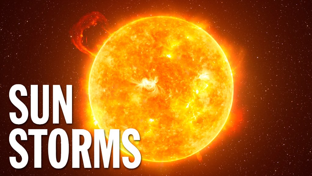
“Space weather can be defined most basically as the impact solar storms have on Earth’s atmosphere and below,” explains SANSA Hermanus MD Dr Lee-Anne McKinnell. The Sun is continually ejecting, from its corona, and in all directions, charged particles (mainly protons and electrons), and this particle flow is called the solar wind (it creates and maintains an enormous bubble around our Solar System, known as the heliosphere). But the Sun is often a turbulent body, and produces a number of different types of events and storms. There are (extra) high speed solar wind streams, which originate in areas on the Sun called coronal holes. There are also solar flares, which are intense bursts of radiation resulting from the release of magnetic energy associated with sunspots. And there are coronal mass ejections (CMEs), which are large clouds of plasma and magnetic field which erupt from the Sun.
From any effects of the routine solar wind, the Earth is protected by its magnetic field. But major events like particularly strong solar flares, or CMEs, which come straight at the Earth, could disturb the terrestrial magnetic field to such a degree that it could affect ground-based electronic and electrical systems, perhaps even severely. This actually happened in 1859 when a major CME eruption, now called the Carrington Event, disabled electrical telegraph systems, particularly in the northern hemisphere, for days.
Today, we are even more vulnerable to space weather, with our heavy reliance on aircraft for transport, and on satellites for communication and navigation (global navigation satellite services, or GNSS, of which the American GPS is the best known and most widely used). Satellites in Earth orbit can be damaged by these solar storms, disrupting both communications and GNSS. Airliners (and their crews and passengers) in flight could be affected, and even power transmission lines could be damaged.
Getting There
SANSA presented the business case for the SWC to government, and received approval for it, in 2019. Establishment of the new facility took three years (and was undertaken despite the Covid-19 pandemic) and required the construction of a new and dedicated building, as well as the installation of a generator (in its own housing) to ensure a continuous power supply during periods of loadshedding (scheduled rotating power cuts imposed by the national electricity utility, Eskom, due to its lack of generating capacity), as well as the building of accommodation to house visiting researchers (because affordable accommodation is difficult to access in Hermanus) – the SWC will also be a research centre as well as a forecasting centre – while the existing accommodation for postgraduate students (doing research at SANSA Hermanus) was extended.
The construction of these buildings was one of the seven subprojects into which SANSA divided the SWC establishment programme. Another one was to obtain ISO 9001:2015 certification, for quality assurance; this was achieved early this year. A third subproject was and is a major human skills development programme, to both recruit and train space weather forecasters; so far, they have mainly been recruited from meteorology and physics graduates, with the first batch trained and now working, and the second batch undergoing training, and preparations being made to train the third batch. A fourth subproject was the creation of the very substantial information and communications technology infrastructure needed by the SWC. The start of the development of the Africa Instrumentation Network was a further subproject, while the commencement of the development of products and services to be offered by the SWC was yet a further subproject. The final subproject was and is SWC communications and business development activities.
Although the establishment and initial operating of the SWC was and will be funded by the State, the aim is for the SWC to become partly self-funding over time, through the sale of products and services to commercial clients. The essential precondition for this was obtaining ICAO’s recognition of the SWC as a regional space weather centre.
“To be designated as a regional space weather centre, ICAO requires that we operate in at least three domains,” highlights SANSA communications practitioner Daleen Fouché. “These are high frequency (HF) radio communication, navigation and surveillance, and radiation exposure. We’ve operated in the HF radio communication domain for a long time and we consider ourselves a centre of excellence in HF communications. HF is very important on the African continent, especially in the defence sector. Solar flares can cause HF radio blackouts, and this is a very important issue.”
Navigation refers to GNSS. Geomagnetic storms can cause GNSS to become less accurate. Aircraft have very little room for navigational error, and a small inaccuracy early in a long-haul flight could compound into a major course deviation later in the flight, which would reduce the safety of that flight.
And long-haul flights, their crews and passengers, could also be affected by heightened levels of radiation exposure, at the high altitudes that airliners fly on these routes, resulting from space weather events. Flights across the poles could also be affected by such radiation, as the poles are where the Earth’s magnetic field lines converge.
“Aviation was the catalyst for developing our operational [24/7/365] capability, but it won’t be the only sector we’ll support,” she explains. “The defence industry is already a client. And
we’re looking at developing products and services for other industries. We need to find out their user requirements. We’re looking at mining and energy industries; we need to find out how they use GNSS and how serious space weather impacts on GNSS would be for them. We’re also looking at shipping and agriculture.”
The SWC normally issues one space weather forecast bulletin every day, but, should a solar storm occur, it would also issue a warning. The SWC now has eight forecasters and is aiming for 12. There are two shifts, day and night. The day shift requires one forecaster, because she – or he – can be backed up by SANSA’s space weather researchers, but the night shift requires two, to back each other up, as no other scientific support is normally available at night.
The forecasting is done in a dedicated control room, dominated by a ‘screen wall’ composed of multiple display screens. Seven of these show images of the full solar disk, but in different wavelengths, to show different levels of the Sun and different solar phenomena, such as sunspots, coronal holes, and filaments on the Sun’s surface. Two screens, set to different scales as well as wavelengths, obscure the Sun, so that its corona can be clearly seen. Other screens display ground- and satellite-based data in graphical form.
Data, Instruments and Networks
The SWC is totally dependent on data, for both research and forecasting purposes.
“We get our data in near real time,” elucidates McKinnell. “Our data sources are solar observation satellites and a ground-based instrumentation network. This network belongs to SANSA, and is spread across the country, plus the [Gough and Marion] islands and Antarctica. We’re going to expand the network, across Africa. As a recognised regional centre, we need to be able to forecast for Africa, so we need to bring in data from across the continent. This expansion will be jointly funded by SANSA and our African partners, which include space agencies and universities.”
The ground-based instrumentation network uses three kinds of sensors. The two most common types are magnetometers and GNSS receivers. The third, less common, type, is an ionosonde system, which is a ground-based radar system for measuring the ionosphere. In addition, SANSA has its SuperDARN radar system, and a pair of very low frequency (VLF) radio antennas, at the South African National Antarctic Expedition (SANAE) base in the Antarctic. (SuperDARN stands for Super Dual Auroral Radar Network.)
“The SuperDARN radar and the other Antarctic-based instruments give us very important information because they look up the Earth’s magnetic field lines, giving us a window into ‘geospace’,” she points out. “Geospace is the near-Earth space environment.”
VLF radio signals propagate very well from the ground to the upper atmosphere, as the ground is usually electrically conductive and the upper atmosphere is full of charged particles and so also conductive. When lightning occurs (and lightning is always occurring, somewhere in the world), the VLF component of the signal it produces travels very long distances indeed and can be detected by the VLF antennas at SANAE. Now, these lightning- generated VLF signals are affected by geomagnetic storms, produced by space weather events. These effects are quite distinctive, allowing the detection and evaluation of these geomagnetic storms.
Responsibility for, and maintenance of, this instrumentation network is vested in SANSA Hermanus’ Engineering and Data Acquisition (EDA) unit. This unit currently has five full-time and eight contract personnel (the latter category serving in SANSA’s Marion Island and Antarctic overwintering detachments, to avoid ‘overexposing’ personnel to these remote and isolated locations). In total, including Marion Island and Antarctica, this network currently comprises about 80 instruments at 23 operational sites.
“The instrumentation network is growing at a rate of one or two new sites a year,” reports EDA unit manager Jonathan Ward. “We now have some stations in Namibia. But now we’re going to expand more widely across Africa, which is why we are talking of an African Instrumentation Network, instead of, as before, the South African Instrumentation Network. The African network is what we are now focusing on, and it’s a big challenge, because many of the proposed sites, in Kenya, Nigeria and Rwanda, among others, are very remote from South Africa. So, we need local partners, to host and maintain the instruments. Finding the right partners is a challenge, for we need partners that can use the data for their own research projects, and not just maintain the instruments. Also, SANSA’s budget is limited, so we need to encourage other African countries to create their own space science programmes and their own instrumentation networks. SANSA can and will provide technical knowledge and support, including assistance in drawing up science and funding proposals, to achieve this. We’ve already seen some very good results from this methodology.”
Usually, the first ground instrumentation station to be set up in another African country is a simple and straightforward one, comprising only a GNSS instrument, a power source and an antenna. The interesting thing is that many African countries already have GNSS stations spread across their territories, but these are for mapping purposes, and so are not networked, cannot relay their data in real time, and so are of no value regarding space science. Exposure to a networked GNSS station has led to a number of African countries starting to convert their existing GNSS stations into a network, relaying data in real time, and allowing the development of local space science capabilities. And now some are showing interest in acquiring magnetometers and setting up geomagnetic stations as well.
Article Enquiry
Email Article
Save Article
Feedback
To advertise email advertising@creamermedia.co.za or click here
Comments
Press Office
Announcements
What's On
Subscribe to improve your user experience...
Option 1 (equivalent of R125 a month):
Receive a weekly copy of Creamer Media's Engineering News & Mining Weekly magazine
(print copy for those in South Africa and e-magazine for those outside of South Africa)
Receive daily email newsletters
Access to full search results
Access archive of magazine back copies
Access to Projects in Progress
Access to ONE Research Report of your choice in PDF format
Option 2 (equivalent of R375 a month):
All benefits from Option 1
PLUS
Access to Creamer Media's Research Channel Africa for ALL Research Reports, in PDF format, on various industrial and mining sectors
including Electricity; Water; Energy Transition; Hydrogen; Roads, Rail and Ports; Coal; Gold; Platinum; Battery Metals; etc.
Already a subscriber?
Forgotten your password?
Receive weekly copy of Creamer Media's Engineering News & Mining Weekly magazine (print copy for those in South Africa and e-magazine for those outside of South Africa)
➕
Recieve daily email newsletters
➕
Access to full search results
➕
Access archive of magazine back copies
➕
Access to Projects in Progress
➕
Access to ONE Research Report of your choice in PDF format
RESEARCH CHANNEL AFRICA
R4500 (equivalent of R375 a month)
SUBSCRIBEAll benefits from Option 1
➕
Access to Creamer Media's Research Channel Africa for ALL Research Reports on various industrial and mining sectors, in PDF format, including on:
Electricity
➕
Water
➕
Energy Transition
➕
Hydrogen
➕
Roads, Rail and Ports
➕
Coal
➕
Gold
➕
Platinum
➕
Battery Metals
➕
etc.
Receive all benefits from Option 1 or Option 2 delivered to numerous people at your company
➕
Multiple User names and Passwords for simultaneous log-ins
➕
Intranet integration access to all in your organisation


